Friends of the Eel River has long been pursuing more clarity from PG&E on dam safety at the Potter Valley Project. The utility company has long made the choice to classify dam safety and emergency planning documents related to the project as “Critical Energy Infrastructure Information” or CEII, thus concealing critical details about stability and safety from the public. There is a long list of reasons to be wary of the stability of Scott Dam, including the proximity to an active landslide on the south abutment, the unusual design in part necessitated as a last-minute adjustment to shifting boulders from the landslide back in 1920, the accumulation of sediment on the upstream side of the dam, and, of course, its location on the Bartlett Springs Fault. A new assessment of dam safety issues at the project prompted PG&E to make a rapid decision to reduce the capacity of the reservoir for the remainder of the dam’s life.
The Federal Energy Regulatory Commission (FERC) licenses this hydropower project and has the authority to rescind CEII designations if they determine the information could no longer be used to impair security or reliability of energy infrastructure. This project no longer even generates energy, and never will again. PG&E has also designated inundation maps as CEII, despite the fact that the California Division of Safety of Dams routinely publishes these documents on their website. Other documents, including Emergency Action Plans, could provide useful information to enhance public safety, and in some cases are already widely distributed to emergency responders, elected officials, and others – but not to downstream residents.
We and allied organizations wrote to FERC requesting that the agency both stop accepting PG&E’s continued classification of Potter Valley Project inundation maps as CEII and make public PG&E’s CEII justification statements. You can read our letter here.
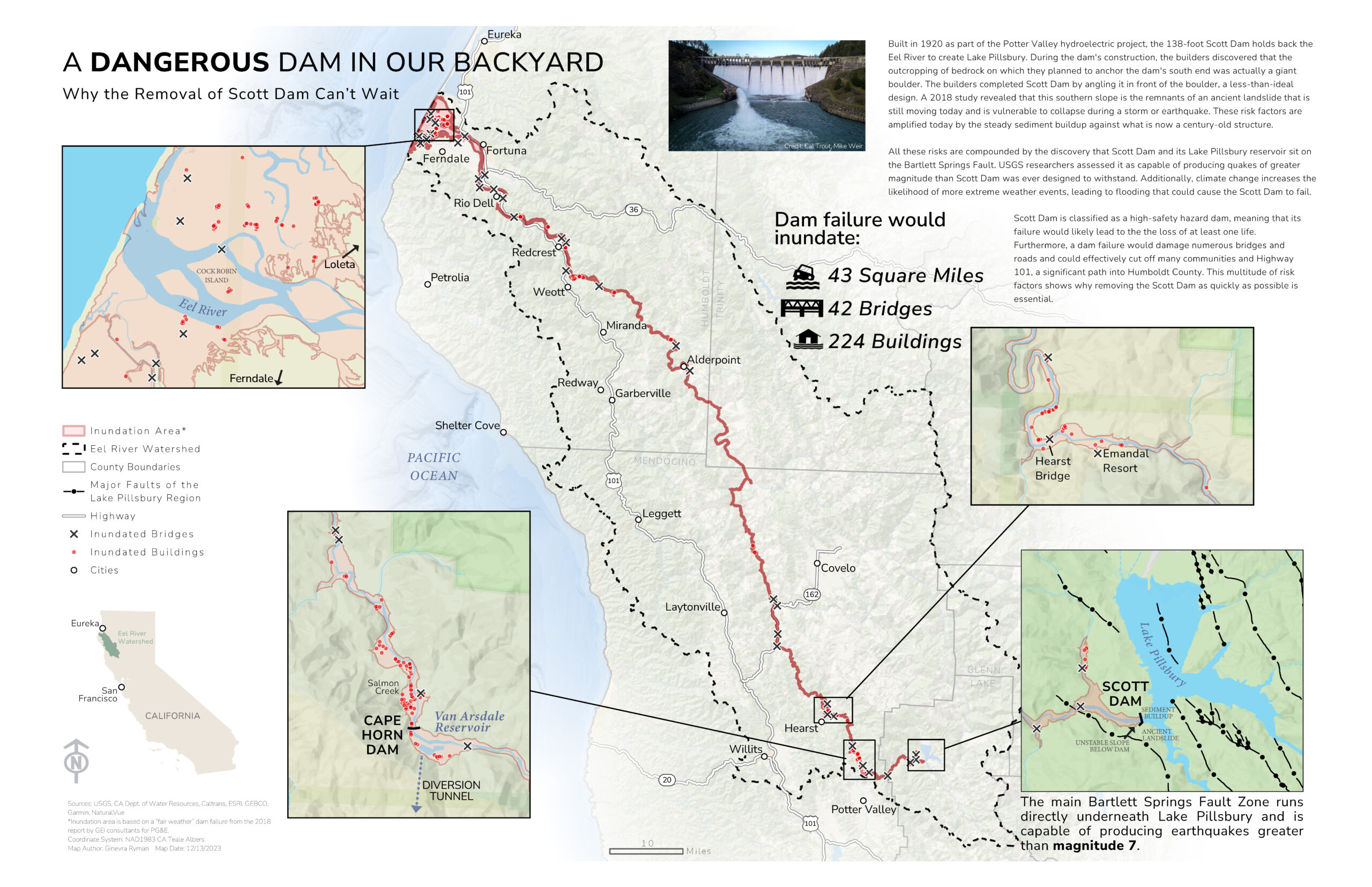
We have also created an inundation map highlighting why the removal of Scott Dam cannot wait:

We’ll have prints available of this detailed map by Ginevra Ryman at in-person events this summer and fall.
